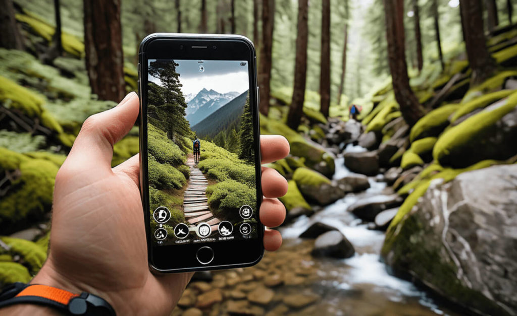
Apps have become an integral part of our lives, and they can greatly enhance the hiking and outdoor experience. Whether you are a seasoned hiker or a passionate outdoor enthusiast, there are a variety of apps available that can enrich your adventures. These apps offer a range of benefits, from navigation and weather updates to safety features, fitness tracking, and even photography assistance.
Using apps for hiking and outdoor activities provides numerous advantages. These include getting accurate and reliable navigation assistance, accessing detailed maps for trails, tracking fitness metrics, receiving real-time weather updates, learning about local wildlife and flora, and ensuring safety through emergency communication tools.
When it comes to navigation, certain apps such as GPS Navigation and Maps, AllTrails, and Gaia GPS offer advanced features like offline map downloading, trail recording, and waypoints, ensuring that you never lose your way in unfamiliar terrains.
Weather apps designed specifically for hikers, including AccuWeather, Weather Underground, and Dark Sky Weather, provide hyperlocal forecasts, temperature information, and radar maps, helping you plan your hikes accordingly and stay prepared for weather changes.
Safety is paramount during outdoor activities. Apps like First Aid – American Red Cross, Emergency SOS – Stay Safe, and Zello PTT Walkie Talkie offer essential safety information, emergency contact tools, and real-time communication capabilities to keep hikers and outdoor enthusiasts safe during their adventures.
For fitness enthusiasts, apps like Strava, MapMyHike, and Endomondo offer activity tracking, route recording, and performance analysis, allowing you to monitor your progress, set goals, and share achievements with fellow hikers.
Lastly, photography and nature apps such as PeakVisor, iBird Pro Guide to Birds, and PictureThis provide identification tools for mountains, birds, and plants respectively, enhancing your nature exploration and helping you capture the beauty of the outdoors.
With the benefits of these various app categories, hikers and outdoor enthusiasts can enhance their experiences, stay safe, and make the most out of their adventures.
Key takeaways:
- Navigation apps enhance hiking experience: GPS-based navigation apps like GPS Navigation and Maps, AllTrails, and Gaia GPS provide detailed trail maps, route planning, and offline navigation, helping hikers stay on track and explore new trails.
- Weather apps keep hikers informed: AccuWeather, Weather Underground, and Dark Sky Weather provide real-time weather updates, forecasts, and radar maps, enabling hikers to make informed decisions and stay safe in changing weather conditions.
- Hiking apps offer safety and fitness features: Apps like First Aid – American Red Cross, Emergency SOS – Stay Safe, Strava, and MapMyHike provide safety information, emergency assistance, and fitness tracking capabilities, ensuring hikers’ well-being and helping them track their progress.
The Benefits of Using Apps for Hikers and Outdoor Enthusiasts
Using apps for hikers and outdoor enthusiasts can offer numerous benefits and enhance the overall experience.
- Navigation: Apps like Gaia GPS and AllTrails provide detailed maps and navigation tools, ensuring hikers stay on the right track.
- Safety: Emergency apps, such as AdventureSmart and Cairn, offer safety features like real-time tracking, emergency contacts, and weather alerts.
- Information: Apps like PlantSnap and iNaturalist help identify plants, animals, and birds, enabling hikers to learn more about their surroundings.
- Community: Apps like REI Co-op and Trailforks allow hikers to connect with like-minded individuals, find new trails, and share experiences.
- Planning: Apps like PeakVisor and Mountain Hub provide valuable information on trail difficulty, elevation, weather conditions, and nearby amenities.
The Benefits of Using Apps for Hikers and Outdoor Enthusiasts are readily apparent. These applications offer navigation features, ensuring that hikers can stay on the right track with the help of detailed maps and useful tools like Gaia GPS and AllTrails. In terms of safety, apps like AdventureSmart and Cairn provide real-time tracking, emergency contact information, and weather alerts to keep hikers secure. Additionally, apps such as PlantSnap and iNaturalist offer valuable information to enthusiasts by helping them identify various plants, animals, and birds in their surroundings. To foster a sense of community, hikers can connect with like-minded individuals, discover new trails, and share their experiences through apps like REI Co-op and Trailforks. Moreover, when it comes to planning, apps like PeakVisor and Mountain Hub prove instrumental by providing essential details such as trail difficulty, elevation, weather conditions, and nearby amenities. With such benefits, it is clear that using apps enhances the overall experience for hikers and outdoor enthusiasts.
Top Navigation Apps for Hiking
If you’re a hiking enthusiast, get ready to take your adventures to the next level with these top navigation apps. From GPS navigation and detailed maps to specialized trail guides, we’ve got you covered. Discover the wonders of GPS Navigation and Maps, explore new trails with the AllTrails app, or dive into the world of off-road and topographic maps with Gaia GPS. Whether you’re a seasoned hiker or just starting out, these apps will revolutionize your outdoor experience. Lace up your boots and let’s dive into the world of hiking technology!
1. GPS Navigation and Maps
Using GPS navigation and maps apps is crucial for hikers and outdoor enthusiasts. These apps provide precise location tracking, detailed maps, and useful features to enhance the hiking experience.
- GPS Navigation and Maps: Apps like GPS Navigation and Maps are invaluable, offering turn-by-turn directions to help hikers stay on track and navigate through unfamiliar trails.
- AllTrails: This widely-used app offers a vast database of hiking trails, enabling users to discover new trails, read reviews, and access trail maps offline.
- Gaia GPS: Renowned for its comprehensive topographic maps and offroad navigation capabilities, Gaia GPS is a favorite among experienced hikers who venture off the beaten path.
During my backpacking trip in the remote wilderness, I heavily relied on my GPS navigation app to navigate through dense forests and challenging terrains. The GPS navigation and maps app accurately guided me, preventing me from getting lost and ensuring my safety and peace of mind throughout the adventure.
2. AllTrails: Hiking, Running & Mountain Bike Trails
AllTrails: Hiking, Running & Mountain Bike Trails
- AllTrails is a popular app that offers a vast database of hiking, running, and mountain biking trails.
- The app provides detailed offline maps, trail descriptions, photos, and reviews shared by a community of outdoor enthusiasts.
- Users can filter trails based on difficulty level, length, elevation gain, and more to find the perfect running & mountain bike trail for their preferences and fitness level.
- AllTrails allows users to track their progress, record their hikes, and save their favorite running & mountain bike trails for future reference.
- With its GPS tracking feature, the app ensures that users stay on the designated running & mountain bike trail and never get lost.
3. Gaia GPS: Hiking, Offroad Maps, Topo Maps
Gaia GPS is an outstanding app tailored specifically for hikers and outdoor enthusiasts. It provides an extensive range of maps and navigation tools to greatly enhance your hiking adventure.
- Offroad Maps: Gaia GPS offers comprehensive offroad maps that enable you to effortlessly explore remote areas off the well-worn trails.
- Topo Maps: Gain access to the app’s exceptional topographic maps, which offer detailed information on elevation, terrain contours, and other vital data crucial for navigating hiking trails.
- Hiking Features: Gaia GPS empowers you to plan and track your hikes, conveniently mark waypoints, record tracks, and accurately measure distances.
- Offline Capability: By utilizing Gaia GPS, you can conveniently download maps in advance and utilize them without an internet connection, ensuring seamless connectivity even in the most remote surroundings.
- Community and Sharing: Immerse yourself in Gaia GPS’s vibrant community, where avid hikers share their preferred trails, valuable tips, and unforgettable experiences.
For an uninterrupted and pleasurable hiking experience, make sure to utilize Gaia GPS to effortlessly navigate, explore, and stay connected while enjoying the wonders of the great outdoors.
Weather Apps for Hikers
Get real-time weather updates while you hit the trails with these top-notch weather apps for hikers. From detailed forecasts to hyperlocal weather maps and live radar, these apps keep you informed about the ever-changing weather conditions. Whether you need to know if it’s going to rain or track temperature variations, we’ve got you covered. Discover how AccuWeather, Weather Underground, and Dark Sky Weather can be your reliable companions on your outdoor adventures.
1. AccuWeather: Weather Tracker & Live Forecast Maps
The AccuWeather app, known as the AccuWeather: Weather Tracker & Live Forecast Maps, is a preferred choice for hikers and outdoor enthusiasts seeking dependable weather information and live forecast maps.
- Accurate Forecast: Utilize the AccuWeather app to receive real-time weather updates and precise forecasts, enabling you to plan your hiking trips accordingly.
- Interactive Maps: Take advantage of the live forecast maps provided by AccuWeather: Weather Tracker & Live Forecast Maps to track weather patterns, such as temperature, precipitation, and wind speed.
- Customizable Alerts: Ensure your safety on the trails by setting up personalized alerts on the AccuWeather app for severe weather conditions, including thunderstorms or heavy rainfall.
- Outdoor Activity Planning: Before embarking on outdoor activities like hiking, camping, and biking, the AccuWeather app offers specific weather details to assist you in making informed decisions.
- Additional Features: Enhance your outdoor experience with the AccuWeather: Weather Tracker & Live Forecast Maps app, which includes radar maps, satellite imagery, and hourly forecasts.
For years, AccuWeather has been a trusted source of reliable weather information, trusted by millions of users worldwide.
2. Weather Underground: Hyperlocal Weather Maps & Radar
Weather Underground, with its hyperlocal weather maps and radar functionality, is a widely used app among hikers and outdoor enthusiasts. This app offers detailed and up-to-date weather information specific to your location, allowing you to plan your outdoor activities accordingly. With the interactive radar feature, you can track storms, precipitation, and other weather patterns in real-time, ensuring your safety and preparedness during your adventures. Weather Underground also provides customizable alerts and notifications, keeping you informed about any changes in weather conditions. Whether you’re hiking, camping, or engaging in any outdoor activity, Weather Underground’s hyperlocal weather maps and radar make it an invaluable tool to have on your smartphone.
3. Dark Sky Weather
Dark Sky Weather is an essential app for hikers and outdoor enthusiasts, providing accurate weather forecasts and real-time updates to ensure a safe and enjoyable experience.
- Hourly Forecasts: Stay informed about changing weather conditions throughout your hike with detailed hourly forecasts.
- Hyperlocal Data: Dark Sky Weather uses advanced algorithms and radar technology to provide highly precise weather information specific to your location.
- Alerts and Notifications: Receive severe weather alerts and notifications so you can adjust your plans and seek shelter if necessary.
- Interactive Maps: Use interactive maps to track storms, view precipitation patterns, and plan your route accordingly.
The Dark Sky Weather app was initially launched in 2012 and quickly gained popularity among outdoor enthusiasts for its accuracy and user-friendly interface. In 2020, Dark Sky Weather was acquired by Apple, which further enhanced its features and integrated it with the iOS ecosystem. Today, Dark Sky Weather remains a top choice for hikers seeking reliable weather information while exploring the great outdoors.
Apps for Safety and Communication
Ensure your safety and stay connected while exploring the great outdoors with these essential apps. Discover the power of the American Red Cross First Aid app, your trusted companion for emergencies. Be prepared for any situation with Stay Safe’s Emergency SOS feature. And stay in touch with your group using the reliable Zello PTT Walkie Talkie app. Don’t leave home without these safety and communication tools on your next hiking adventure.
1. First Aid – American Red Cross
The American Red Cross First Aid app is an essential tool for hikers. In emergency situations on the trails, it’s crucial to have basic first aid knowledge and guidance. Here are the steps to effectively use this app:
- Download the American Red Cross First Aid app from your app store.
- Open the app and explore the different sections, including “Learn,” “Prepare,” and “Emergency.”
- Use the “Learn” section to gain valuable knowledge about different first aid techniques and procedures provided by the American Red Cross.
- Utilize the “Prepare” section to create a personalized emergency plan for your hiking trips.
- Access the “Emergency” section during an actual emergency to get step-by-step instructions on how to handle various injuries or situations, as recommended by the American Red Cross.
Pro-tip: Remember to keep your phone charged and waterproofed when hiking so that you can access the American Red Cross First Aid app whenever needed.
2. Emergency SOS – Stay Safe
In case of emergencies while hiking or engaging in outdoor activities, having the Emergency SOS – Stay Safe app can be crucial. Here are some steps to consider when using the Emergency SOS – Stay Safe app:
- Download and install the Emergency SOS – Stay Safe app on your mobile device.
- Create an account and set up your emergency contacts for the Emergency SOS – Stay Safe app.
- Familiarize yourself with the features of the Emergency SOS – Stay Safe app, such as panic buttons, GPS tracking, and emergency notifications.
- Ensure that your location services are enabled for accurate tracking with the Emergency SOS – Stay Safe app.
- If you find yourself in a dangerous or life-threatening situation, activate the SOS feature of the Emergency SOS – Stay Safe app.
- The Emergency SOS – Stay Safe app will alert your emergency contacts with your location and provide regular updates.
- Stay on the line or communicate with your contacts until help arrives using the Emergency SOS – Stay Safe app.
By following these steps and having the Emergency SOS – Stay Safe app on hand, you can enhance your safety and peace of mind during your outdoor adventures.
3. Zello PTT Walkie Talkie
Using the Zello PTT Walkie Talkie app can greatly enhance the safety and communication of hikers and outdoor enthusiasts. Here are some steps to maximize the benefits of the Zello PTT Walkie Talkie app:
- Download and install the Zello PTT Walkie Talkie app on your smartphone.
- Create an account and set up your profile.
- Add contacts to your Zello PTT Walkie Talkie app, including fellow hikers or members of your hiking group.
- Establish communication channels or groups within the Zello PTT Walkie Talkie app to easily connect with specific individuals or teams.
- Set your status to “Available” when you are ready to communicate and receive messages using the Zello PTT Walkie Talkie app.
- Utilize the push-to-talk (PTT) feature of the Zello PTT Walkie Talkie app to communicate instantly with others at the touch of a button.
- Take advantage of the Zello PTT Walkie Talkie app’s location-sharing feature to ensure others can track your whereabouts while hiking.
- Make use of the Zello PTT Walkie Talkie app’s text messaging and photo-sharing capabilities for additional communication options.
- Regularly check for app updates of the Zello PTT Walkie Talkie app to ensure smooth functioning and access to the latest features.
Fitness and Activity Tracking Apps for Hiking
Looking to elevate your hiking game? Get ready to track your fitness and activity levels like a pro with these must-have apps. We’re diving into the world of fitness and activity tracking apps for hiking, where we’ll explore the features of Strava, MapMyHike, and Endomondo. From tracking your routes to recording your progress, these apps have got you covered on the trails. Lace up your boots and let’s discover the perfect app to enhance your hiking adventures.
1. Strava: Track Running, Cycling & Swimming
Strava is a popular app for tracking running, cycling, and swimming activities.
- Activity tracking: Strava allows users to track their runs, bike rides, swimming sessions, and swims using GPS technology.
- Performance analysis: The app provides detailed statistics on distance, pace, speed, elevation, and calories burned during cycling and swimming.
- Community and motivation: Strava allows users to connect with friends, join cycling and swimming clubs, and compete in challenges, providing a supportive community and motivation to stay active.
- Route exploration: Users can discover new routes and trails for cycling and swimming through the app, with the option to save and share their favorite routes with others.
- Integration with other devices and apps: Strava seamlessly syncs with various fitness trackers, smartwatches, and other apps, making it easy to track and analyze data related to cycling and swimming.
2. MapMyHike: Hiking, Running, Walking, GPS Tracking
MapMyHike is a popular app among hikers, runners, and walkers for its GPS tracking and route mapping features.
- Hiking: MapMyHike allows users to track their hikes, providing real-time information about distance, elevation, and pace.
- Running: The app also caters to runners, offering features like route suggestions, audio coaching, and performance tracking.
- Walking: For those who prefer leisurely walks, MapMyHike can track walking routes and provide insights into calorie burn and step count.
- GPS Tracking: The app uses GPS technology to accurately track outdoor activities, ensuring users can monitor their progress and navigate through unfamiliar trails.
Fact: MapMyHike has over 20 million downloads worldwide, making it one of the most popular hiking and fitness apps available.
3. Endomondo – Running & Walking
Endomondo is a popular fitness and activity tracking app that caters specifically to runners and walkers. It offers various features that make it a great tool for hikers as well.
- GPS Tracking: Endomondo uses GPS to track the distance, duration, and route of your hike, providing accurate data for analyzing your performance.
- Workout Metrics: The Endomondo – Running & Walking app records metrics like pace, speed, and elevation, allowing you to monitor your progress and set goals for future hikes.
- Audio Feedback: Endomondo provides audio updates during your hike, giving you real-time information on your pace and distance.
- Social Features: You can connect with friends, join challenges, and share your hiking achievements on the Endomondo – Running & Walking app, fostering a sense of community.
With its user-friendly interface and comprehensive features, Endomondo – Running & Walking is a valuable app for hikers looking to track their hikes, improve their fitness, and connect with other outdoor enthusiasts.
Photography and Nature Apps for Hikers
Capture the beauty of nature while hiking with these must-have photography and nature apps. From identifying breathtaking mountains with PeakVisor to learning about various bird species using iBird Pro Guide to Birds, and even identifying plants and flowers with PictureThis, this section will take your outdoor adventures to new heights. Say goodbye to missed photo opportunities and hello to enhancing your knowledge of the natural world.
1. PeakVisor: Mountains Identifier
PeakVisor is a highly recommended app for hikers and outdoor enthusiasts to identify mountains. With its advanced augmented reality technology, PeakVisor, the mountains identifier app, overlays detailed 3D mountain profiles onto your camera view, helping you recognize peaks even without an internet connection. Additional features of PeakVisor include the ability to measure altitude, save favorite peaks, and search for peaks by name or location. Whether you’re planning your next hiking adventure or simply curious about the mountains around you, PeakVisor, the mountains identifier app, is an essential tool to enhance your outdoor experience.
Pro-tip: Use PeakVisor, the mountains identifier app, to impress your hiking buddies by easily identifying the peaks you encounter on your journeys.
2. iBird Pro Guide to Birds
The iBird Pro Guide to Birds is a must-have app for bird enthusiasts and hikers alike. With an extensive database of over 1 million bird sightings and detailed information on species, the iBird Pro Guide to Birds offers a comprehensive guide to identify birds in the wild. The app features stunning images, bird songs, and a search function based on location, shape, color, and more. Whether you’re a beginner or an experienced birder, the iBird Pro Guide to Birds is an invaluable tool to enhance your hiking experience.
- Extensive database: Access over 1 million bird sightings and detailed species information.
- Identification made easy: Utilize the search function based on various characteristics like location, shape, and color.
- Stunning visuals and audio: Enjoy high-quality images and bird songs to aid in identification.
Fact: Did you know that there are approximately 10,000 species of birds worldwide? The iBird Pro Guide to Birds helps you explore this incredible diversity while on your hiking adventures.
3. PictureThis: Identify Plant, Flower, Weed and More
PictureThis: Identify Plant, Flower, Weed and More
- Download the PictureThis app from your mobile app store.
- Open the app and grant permission to access your device’s camera.
- Take a clear photo of the plant, flower, or weed you want to identify.
- Wait for the app to analyze the photo and provide you with the name and information of the plant.
- Explore the app’s database to learn more about different plants, flowers, and weeds.
Did you know? The PictureThis app has a large database of over 10,000 plant species, making it a valuable tool for nature enthusiasts and gardening enthusiasts.
Frequently Asked Questions
What are hiking apps and why are they useful for hikers and outdoor enthusiasts?
Hiking apps are digital applications installed on smartphones or other devices that help plan and record hiking trips. They offer mapping capabilities, navigation tools, GPS tracking, and other features to enhance the hiking experience. These apps are useful for hikers and outdoor enthusiasts because they provide trail information, track hiking statistics, allow offline access to maps, help in trip planning, and connect with other hikers.
What are some popular hiking apps available in the market?
Some popular hiking apps available in the market include Gaia GPS, AllTrails, and Outdoor Active. These apps offer various features such as offline navigation, trail discovery, tracking hiking statistics, and connecting with other hikers.
How do hiking apps help in trip planning and trail discovery?
Hiking apps have extensive databases of information that make it easy to discover new trails based on various criteria. They allow users to search for trails locally or globally, filter results based on difficulty level or length, and read reviews from other hikers. Additionally, many hiking apps provide trail descriptions, maps, photos, and user-generated content that aids in trip planning and trail inspiration.
Can hiking apps be used offline? How does offline navigation work?
Yes, many hiking apps offer offline functionality. Users can download maps and trail information beforehand and access them even without an internet connection. Offline navigation works by utilizing GPS tracking on the device, allowing hikers to see their location on the downloaded map and follow the trail even without reliable phone reception.
What safety features do hiking apps offer for hikers?
Hiking apps offer several safety features to enhance hiker’s safety. One of the important features is the ability to share your location in real-time with friends or emergency contacts. Additionally, some apps provide safety alerts, weather updates, and information on points of interest or hazards along the trail. However, it is important to note that hiking apps should be considered backup tools for navigation, and hikers should prioritize learning navigation and safety skills that do not solely rely on technology.
Are there any limitations or potential concerns with using hiking apps?
While hiking apps provide many benefits, they also have limitations and potential concerns. Some limitations include the need for common sense and preparation alongside the app’s usage, as well as privacy concerns. It is important for hikers to bring essential items, learn navigation skills, and not solely rely on technology. Additionally, hikers should consider privacy settings and the disclosure policy of the app when using it.